Utah is a state located in the western region of the United States. It is bordered by Nevada to the west; Idaho and Wyoming to the north; Colorado and Wyoming to the east; and Arizona to the south.
CLIMATE: Generally very dry. Warm summers, cold winters. Heaviest rain in mountains; winter snow.
State Flag
State Seal
On July 23rd, 1847, while a wagon train of Mormons still labored across the plains behind him, Brigham Young of the Latter-day Saints came into the Salt Lake basin and spoke words that would gain lasting fame: “This is the place”. Thus ended an epic exodus of some 1,500 miles from Illinois and Missouri. But many Mormons wondered at their leader’s choice of the promised land. It was-and is- literally the hard earth. The settlers found that their wooded plows were broken by the sun-baked soil. To make their land easier to till, they flooded it with water drawn from the snow-fed streams running down the slopes of the nearby Wasatch Range. When hot summers disclosed there was insufficient rainfall to support crops, the mountain water proved to be beneficial. In this chance manner, the irrigation of the west began (The practice of irrigation dates back to early Egypt and the Nile River).
Eventually, the practice spread into all the western states. It revolutionized traditional concepts about water law, which declares that a downstream property holder is entitled to the same amount of water as an upstream owner. Eventually, the statutes of western states, following the lead of a law enacted by Utah in 1854, proclaim that whoever first uses the water of a stream for a beneficial purpose controls the water flow-“first in time-first in right”. Today, it’s much more complicated. Mountain River water is managed and operated under numerous compacts, federal laws, court decisions and decrees, contracts, and regulatory guidelines collectively known as “The Law of the River.” Mountain States are governed by decrees made as to the depletion rate of their rivers over a 10 year period. These rates allow for periodic adjustments for rainfall and snowpack fluctuations according to the original agreements.
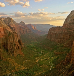
Zion National Park, Utah
The eastern fringe of the Utah plateau is still watered by the runoff from the Wasatch Range, but manufacture and mining outrank agriculture. In the 1940’s and 1950’s Bingham Canyon Mine was booming, at the time producing almost one-third of the uranium in the United States. Although uranium production has declined over the years, ore from the mine has yielded more than 17 million tons of copper, 5,900 tons of silver, 715 tons of gold, and more than 850 million pounds of molybdenum. The Bingham Canyon Mine has been in operation for more than 100 years, and will continue to operate into the 21st Century.
FUN FACTS:
The names Utah, Uinta, and Wasatch all derive from the Ute people. Utah means people of the mountains.
Rainbow Bridge, in the national monument of the same name, is the world’s largest natural stone bridge.
The Great Salt Lake is three to five times saltier than the ocean and the largest lake west of the Mississippi River. It is the remnant of a much larger ancient inland sea called Lake Bonneville.
Utah’s spectacular scenery is preserved in five national parks, seven national monuments, two national recreation areas, and six national forests.
The world’s first transcontinental railroad was completed on May 10, 1869 and celebrated at Promontory where the Central Pacific and Union Pacific Railroads met. It is now known as Golden Spike National Historic Site.
The federal government owns 65% of the state’s land.